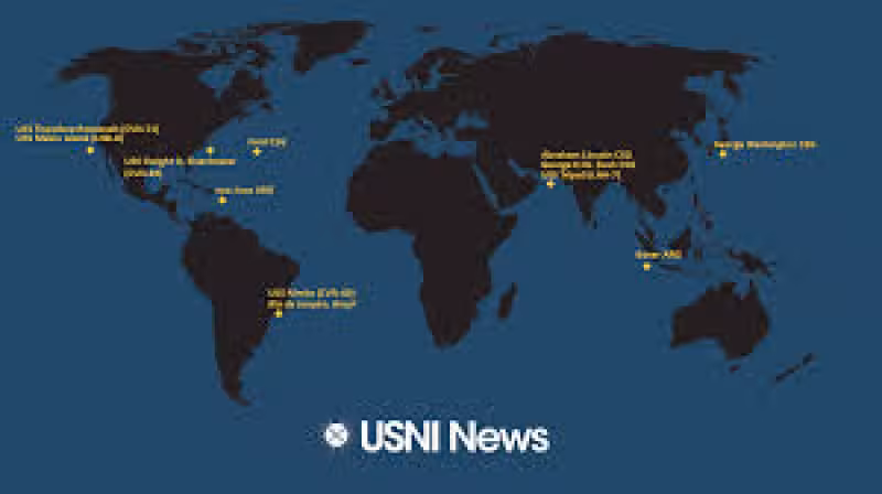
The Naval Update Map published May 7, 2026, shows the approximate current locations of U.S. Carrier Strike Groups and Amphibious Ready Groups. The weekly update is built from available open-source information and does not include classified or operationally sensitive details.
For the U.S. Navy, those formations are the core of its reach at sea. A carrier strike group is centered on an aircraft carrier and brings significant offensive strike capability. An amphibious ready group is centered on three amphibious warfare ships and carries a Marine Expeditionary Unit.
The map matters because it gives a public snapshot of where those two formations are operating right now, without exposing anything that would compromise them. That balance is the point of the update: enough detail to show the fleet’s posture, not enough to reveal what commanders would want kept private.
What the map does not show is just as important as what it does. It is an approximation, not a live tactical feed, and the update makes clear that it draws only on open-source information. Even so, the locations of Carrier Strike Groups and Amphibious Ready Groups remain one of the clearest public indicators of how the United States projects power across the world’s oceans.
The question now is not whether these formations matter. They do. The question is how long the map will show them concentrated where they are today, and what that says about U.S. naval priorities in the days ahead.