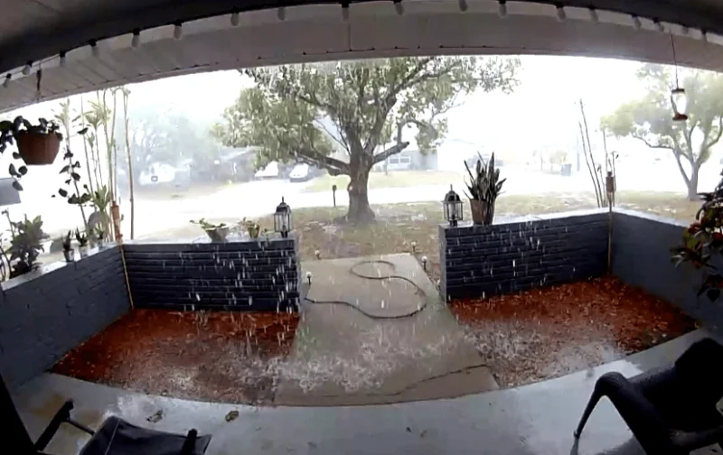
Widespread storms produced several tornado warnings this afternoon in Pasco and Hernando counties, a sharp burst of severe weather that also brought heavy rainfall, lightning and gusty winds across much of the Tampa Bay region. The severe potential has since diminished, but the storm system still left a messy afternoon in its wake.
Heavy rainfall, lightning and gusty winds were seen across Citrus, Hernando, Pasco and Polk counties as the strongest cells moved through. Rain may still fall in Hillsborough, Manatee and Sarasota counties, though the storms and rainfall there will be much less robust. For people in Tampa, highs will stay around the mid 80s with a 30% rain chance.
That shift matters because the weather is moving from a brief severe threat to a more familiar late-summer pattern. A weak front will linger near the I-4 corridor into Wednesday morning, while most of the activity should push inland through the afternoon. The coast will have lower rain chances, leaving inland communities more likely to see the day’s passing showers and storms.
For the rest of the week, the forecast changes again. Drier air begins to move in Thursday and Friday, lifting highs from the upper 80s Thursday to around 90 degrees by Friday. By Saturday and Sunday, highs reach the low 90s, a few afternoon showers return Saturday, and rain chances rise a bit more Sunday as moisture slowly builds back in, mainly south of I-4.
The tension in the forecast is the balance between brief relief and a fast return to heat and humidity. Early next week, highs stay in the low 90s with scattered afternoon and evening storms possible, which means the tornado-warning afternoon gives way to a quieter stretch, but not a dry one. For now, the worst of today’s severe weather has passed, and the next notable shift is toward hotter days and more spotty storms rather than another round of widespread warnings.